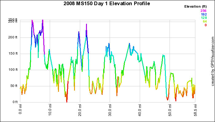
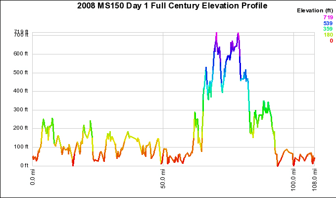
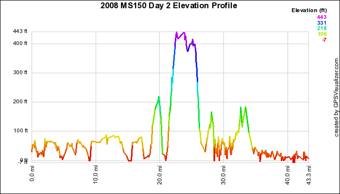
Route Elevation
Home
History
Join Our Teams
About MS
Calender/Discussions
Fundraising
Clothing and Swag
Geocoins
Beginners
Training
30 Miles
100 Miles
150 Miles
Route66 Video
Route Elevation Maps
Training Forums
Photos
Our Sponsors
The following elevation maps are shown here for the 100 and the 150 routes. You can identify the 30 mile route if you look at the first 15 miles of the day two chart.